Top of the World Highway
Best 10 miles of road in Alaska
Monday – August 06, 2018
Clear/rain, 75°
*Note – Sorry for not posting in a while but real life happenings have had me not able to write for a bit. The forest fire smoke caused the severe sinus infection to come back so made things difficult to write but continuing on with this trek south from Alaska through Canada and beyond.
“When all’s said and done, all roads lead to the same end.
So it’s not so much which road you take, as how you take it.”
On Sunday, leaving Big Lake, the drive through Wasilla and Palmer had the sun brightly shining off Pioneer Peak and the several hanging glaciers on the mountaintops. Passing by the Alaska State Fairgrounds, things were being prepared for the upcoming State Fair that was to start in a few weeks. Some things had changed a bit since I left two years ago. The Fred Meyer grocery store that was one of my building projects had closed. The grocery chain had remodeled a bigger building across the highway and had moved into it. It appeared they needed more room and the six year old store was sitting vacant, awaiting the next occupant.
Driving the curvy road along the Matanuska River with its changes in elevation was beautiful. The road starts along the river leading to the glacier and quickly rises several thousand feet above the river with great views of the large, hanging boulders ready to fall down the steep sides into the river below. The treeless mountaintop is above the timberline so the sheer drop-offs show the wintertime avalanche paths. The large debris patterns showed where the snow and ice had sheared off and came crashing down the mountain.
Just as quickly as you are high above the river, with several more turns you descend back to the river’s edge. This happens several times as you go toward the Matanuska Glacier. The drive is pretty in the fall with the trees showing off their bright yellows and the occasional red color. The glacier finally appears where a church sits above the roadway so it is a great stop for pictures of the glacier.
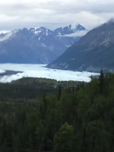
Matanuska Glacier
It has receded a great deal in my twenty years living in Alaska and the width has narrowed to less than half the valley floor. Here, one can clearly see the effects of global warming. All of the glaciers we saw on this trip were drastically reduced in size, several losing almost a mile of their length in just 20 years. It is a shame such beautiful natural settings are withering away right before our eyes. Unfortunately, the world has done little to reverse this trend other than saying this is a receding cycle. In my opinion, this is just political BS and everyone could do more to stop the situation with our vehicle emissions that continue to pollute the atmosphere.
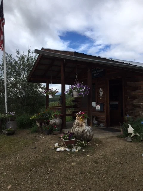
The drive through Eureka would not be complete without a stop at the Eureka Roadhouse for a burger and fries.
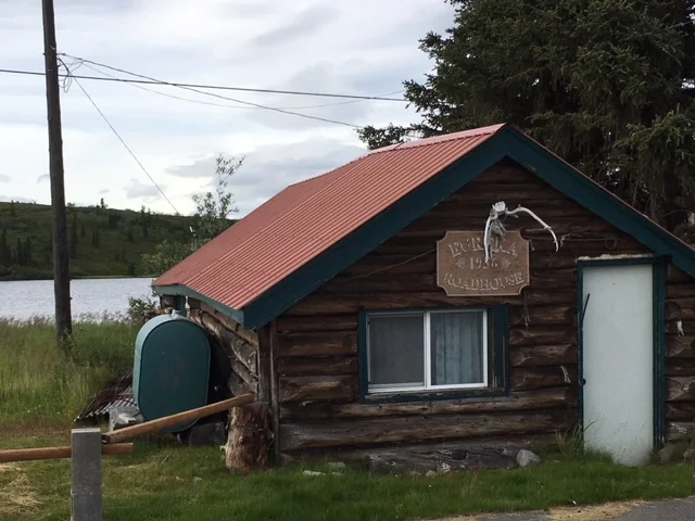
Original Eureka Roadhouse, circa 1936
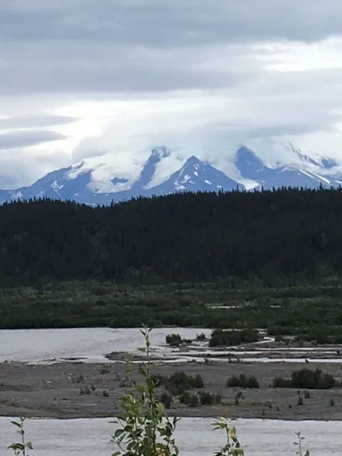
Eureka is about 100 miles from any populated area at the top of an area where wintertime snow machines ride for miles across the tundra. The views are amazing with distant mountains, lakes, glaciers, and abundant wildlife roaming the area. It is also a prime subsistence hunting ground for people to restock their freezers with moose, caribou, turkey, and ptarmigan to survive the long winters found up north. As always, the food was great and hit the spot for the several hours’ drive to Tok where we settled in for the night.
Wrangle – St. Elias Mountains to the East
The road had its share of frost heaving, potholes, and “normal” patching attempts to help the road not be so bumpy but with little effect. At least Alaska and Canada attempt to alert you to a frost heave or “dip” in the road by using little markers. First time drivers in these areas may notice the small flag or small 6” disc stapled to a stick alongside the road but it may take people several jaw-dropping, head banging on the ceiling of their vehicle, moments to realize they are marking the bad spots in the road and to slow down. The fun ones are the unmarked multiple frost heaves that you hit it at 60 mph - the vehicle dips quickly into the first piece of sunken road then flies into the air on the other side of the dip only to come down into another, throwing the vehicle back into the air as one tries to slow down and gain control once again. It is a wild E-ticket ride, things are thrown about inside the vehicle, and the tugs on seat belts and shoulder straps dig into your body or hold you in place during the zero gravity portion of the vehicle’s flight. These are the roads up north and the DOT attempts to repair them each spring but they usually cannot get to all of them before summer tourist season opens to the numerous visitors to the State. It is a way of life traveling the 60 mph roads at a whopping 35 to 40 mph.
The day ended with light rain falling as we made our way into Tok to refuel and find a campsite for the night. It was a quiet place off the highway so one did not hear the many tractor trailer trucks going by on the Alcan. We decided that the morning drive would follow a different route rather than taking the Alcan back through Destruction Bay to Whitehorse in the Yukon.
There is a road (Alaska Route 5) just outside of Tok, Alaska called the Taylor Highway, which turns north towards a little town called Chicken, Alaska. The road is not maintained from mid-October through mid-March making it one of Alaska more interesting drives.
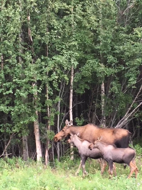
Alaskan Moose Family
It’s about one hundred miles to Chicken and the average speed is about 35 to 45 mph with gravel and dirt portions of the road along the way. There were many frost heaves, gutted dirt road with potholes almost the whole way. It had not been maintained well, if at all, this summer. There are about 50 people who live there in the summer and 6 in the winter months. It is a little quirky town with a post office, a couple of small places to eat, a gift shop with everything “Chicken” on it, an old log post office, and tours of the old abandoned mine operations from the 1880’s.
Chicken Alaska Post Office
There are multiple giant chicken metal sculptures in front of several businesses as you drive through or stop for a bite to eat. Active gold mining continues today but at a much slower and reduced pace than during the gold rush days. There are several big dredges that can be seen on the tours given in town.
“The Town of Chicken was once the mining hub for the Forty mile district. In 1886, ten years before the Klondike Gold Rush, gold was discovered on Franklin Creek and the community of Chicken was founded.
As the story goes, the miners wanted to name the town 'Ptarmigan' after the bird which is common in the area. Unfortunately, people couldn't agree on how to spell it! Finally they settled with the easier name of Chicken. The name stuck and so has the community, despite an up-and-down history of mining in the Forty mile district.” (townofchicken.com) (The 'Ptarmigan' is Alaska’s State Bird)
I met one of my former co-workers, Clifford, who is a helicopter pilot for the Alaska State Troopers for a cup of coffee and while talking he was asking which way I planned to travel back down the Alaska Highway. I told him about going through Chicken and knew he hunted moose in the area and was curious about his thoughts on the road since he travels it several times a year when hunting. He started telling me about the road from the Canadian border station being “the best road in Alaska!” He could not believe the State would put in such a nice road in a place where there weren’t that many people traveling in that part of the State. As I thought about the last few hours driving at 20 to 30 mph over some of the worst roads I have seen in this State I figured my friend was joking about the road conditions. The road had been horrible, mud, potholes, and slow going. It had taken almost five hours to drive just over 100 miles. It was miserable by the time we had gotten to the turnoff toward the small native village of Eagle. I was sure Cliff was full of crap and was probably enjoying the fact I was going on this horrible stretch of highway. I wouldn’t really want to call it a highway since it was dirt and gravel for so much of the way.
This section of highway is called, “Top of the World Highway” as you travel from Whitehorse through the towns of Carmacks (Gold Rush TV show) and Dawson City to the border of Alaska. Approaching the Canadian border with about ten miles remaining the dirt/gravel road suddenly ends and you roll onto this new, black asphalt pavement. All the rattling, jarring, and sounds stop! The road is smooth, so very smooth there is not a sound other than the tires on the asphalt. Nothing; there are no rattles of any kind inside the RV which has not been the case all day or any other day on this trek.
The road is a two lane blacktop, no center line or edging stripes, just smooth road without a ripple in it. That is an amazing feat in itself but it is perfect. But why put the road here? It’s in the middle of nowhere USA, the last ten miles to the border station. Why can’t all state highway DOTs around the country build roads like this one. Arkansas, Utah, Texas, Louisiana could all take lessons from these road builders, it’s perfection. The only thing I can think of is, for those traveling from Dawson City to the border, they travel a gravel road which is okay but still has its issues with potholes and heaves in it. They reach the Alaska border, clear customs and find this beautiful road as they enter the State. They are finally here. Their Alaskan adventure begins and they are driving on this perfect road. The illusion begins but the reality of remote Alaska roads begins in 10 miles. Enjoy it while you can because the next few hours’ drive is going to be your first adventure in this great State.
The border crossing went smoothly. This part of the top of the world had clouds and a fog bank rolling over the ridge line peaks. The clouds rolled up the mountainside, over the road, and descended once again below. Visibility was about a half a mile. You could see over the edges; the rolling mountains were devoid of trees as only small bushes were found here. There were several caribou close to the road but as we stopped to take a photo they scampered further down the hillside.
You descend in elevation all the way to Dawson City. Here, you come to a stop and wait of the ferry to take you across the mighty Yukon River into town.
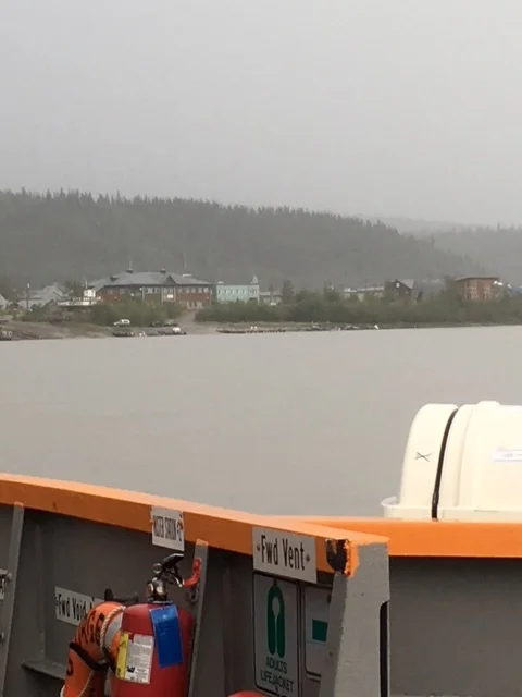
Yukon River Ferry in Dawson Creek
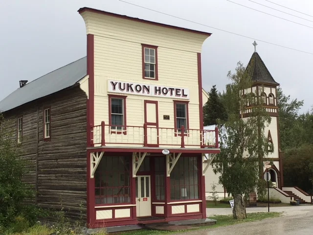
By now it is raining, it only takes a few minutes for the ferry to cross and drop off about 4 or 5 vehicles. The RV and a pickup truck were loaded on the ferry for the return trip across the river. It was raining hard in Dawson City as a thunderstorm was building just south of town. Dawson City is an eclectic and vibrant northern community on the banks of the Yukon River. It boasts a mixture of First Nations Heritage and Gold Rush History blended with an active Gold Mining and Tourism Industry as well as a thriving Arts scene.
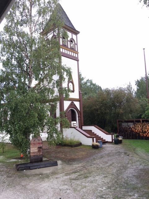
Dawson City Church
“Dawson City, Yukon is the heart of the world-famous Klondike Gold Rush. On August 17, 1896, three Yukon “Sourdoughs”: George Carmack, Dawson Charlie, and Skookum Jim found gold on Rabbit Creek (now Bonanza Creek) a tributary of the Klondike River.
Word of this find quickly spread to the about 1000 prospectors, miners, Northwest Mounted Police, missionaries and others who called the Yukon home at the time. Settlements were quickly abandoned as a rush to stake the best ground commenced.
Two of these residents were Joe Ladue and Arthur Harper who had been trading in the Yukon for years. They were quick to purchase, stake and establish the town site of Dawson (named for Canadian Geologist George Mercer Dawson) at the confluence of the Yukon and Klondike Rivers, about twenty kilometers from Discovery Claim.
News reached the outside world in July of 1897 when the steamships Excelsior and Portland reached San Francisco and Seattle, respectively, with the successful miners from the previous season carrying the infamous “Ton of Gold”. News spread like wildfire of a land where “nuggets could be picked off the creek floor” to a recession suffering world and caused an unprecedented stampede of an estimated 100,000 people to set out to the Klondike.
Most left knowing little of the journey they would undertake. They followed treacherous routes that involved uncharted landscapes, snow-choked mountain passes and freezing rivers to stake their claim to fortune in the Klondike. Most would need to travel over 5000 km to get to Dawson City.
In 1898 Dawson quickly grew as thirty thousand (some say fifty) pick-and-shovel miners, prospectors, storekeepers, saloon keepers, bankers, gambler, prostitutes and adventure seekers took over the town site.
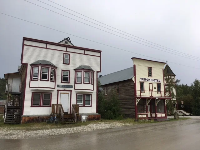
Dawson City Buildings
Most arrived to discover the good ground had been staked in the previous two years. Many simply booked passage home but others stayed and made fortunes through other endeavors. Money was not an issue in Dawson, as gold was in abundance, and businesses that catered to the gold-strapped miners thrived.
From 1896-1899 Dawson $29 million in gold was pulled from the ground around Dawson City.
Dawson became known as the “Paris of the North”: The largest city west of Winnipeg and north of Seattle. Overnight millionaires roamed the streets seeking ways to spend their riches. The best food, drink and clothing were all available for purchase, at a high cost. Dance and gambling halls, bars, brothels, restaurants and supply stores all made fortunes “mining the miners”.
Dawson continued to thrive until gold was found on the beaches of Nome, Alaska in 1899, many of the same people who came seeking fortunes in the Klondike, left Dawson in a new rush.” (www.dawsoncity.ca)
The tailing piles from the old dredges are everywhere as you head south out of town. The ground in this area was worked extensively leaving literally thousands of small piles of rocks neatly side by side for several miles. This area also has piles of volcanic rock in several places dating back through the ages. Today, Dawson City is still a small little community rich with its mining and First Nation’s heritage. The old buildings, the 1880’s theme and the townspeople reviving the old ways make for an interesting stop along anyone’s journey.
A huge thunderstorm with lightening, hard rain, and low visibility slowed the drive to Whitehorse. After several hours and the long, slow day of driving, it was time to stop for the night in a small campground along the Yukon River in Carmacks. There were other campers there doing so many different things; some were rafting, others were visiting the gold mines in the area while others were headed to Alaska along the Top of the World Highway. They would be in for a treat in the morning, while we continued south along the Alaskan Highway along this trek across America.