Key West, Florida to the Arctic Circle, Alaska
Arctic Circle, Alaska
Tuesday, July 24, 2018
Clear, 80°
“It is not the destination where you end up but the mishaps and memories you create along the way.”
One of the things I wanted to accomplish on this adventure was making the drive from the southernmost point in the USA to above the Arctic Circle. The road in Alaska goes a little farther north to the Prudhoe Bay oil fields but the Haul Road is not the place for an RV. Rental car companies ban you from driving it and there is good reason for that.
Dalton Highway Sign
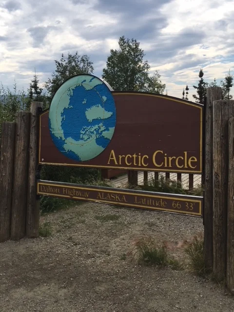
The Arctic Circle way-point is approximately 200 road miles north of Fairbanks on the Dalton Highway, also known as the Haul Road to “Ice Road Trucker” fans. In summer it is a long series of dirt and gravel roads, lots of dust and mosquitoes.
The road from Key West was long, over 10,825 miles and four months across the southern United States, up the California coast and on up through Canada in both British Columbia and Yukon Territory. There have been many varied and unique places visited and stops with friends along the way. New friends were made in campgrounds and gas stations all over the country. The conversations provided all kinds of information as to where people were traveling to, what the purpose of the trip was and how things (from their point of view) were going in America.
People travel for many reasons, like the young man in Canyonlands, Utah who had spent two years on his bicycle traveling from the southern tip of South America. He had made his way north to southern Utah and was headed to Prudhoe Bay, Alaska. He hoped to reach his goal by the end of next summer (2019). We shared a bottle of ice cold drinking water as he talked of his travels.
In the Key West Naval Air Station campground – Lloyd and Jackie Holbert were in a large Class A motorcoach they named Ruby. Not long ago, they had traded in their old coach, Daisy. They were from Virginia and traveling, too - their card said, “On the Road Again Smelling the Roses.”
Terry and Susan Brewer were in the motorcoach next to us. Susan was sitting out front sketching the offshore view from their RV. She is a disabled veteran and they have been full time RV’ing for two years now. Their home base is in South Dakota and they travel all over the United States. They had not yet made it to the Northeastern part of the country when we met but they have made their way through New York and are in Eastern Canada as I write this. We keep in touch as I told them that Maine is still the only State I have not traveled to in the US. We visited for quite a while discussing her love of painting. As it turns out, both Susan and Terry are accomplished artists.
Met a man who was traveling cross country with his daughter, seeing relatives after his wife passed away, they carried a “flat Judy” cutout with her picture on it taking photos of the places visited since Judy was not able to travel before passing.
In my favorite bar in Telluride, Colorado, the Floradora, we met a couple who needed to charge their iPhone; we loaned them a battery pack. It turns out we knew the same people halfway across the country.
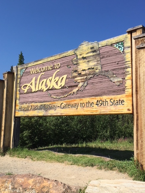
Entering Alaska on the “Alcan” Highway (Alaska/Canadian Highway) near Tok, Alaska the roads are similar to the last several hundred miles of Canadian highway, lots of potholes, frost heaves, and gravel sections. It is about 100 miles from the border to Tok and the roads were a little better that last 25 miles into Tok.

End of Alaska Highway – Milepost 1422
From there to Delta Junction (end of the Alcan) and on into Fairbanks the road is better, not much, but better since it is traveled more.
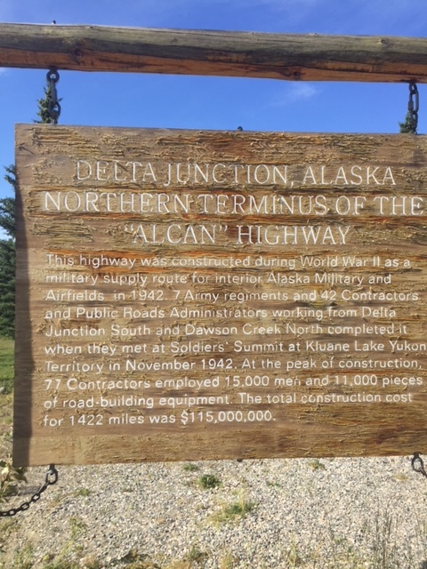
Alcan information sign
There is more road maintenance and construction going on along this stretch of highway.
Once you leave Fairbanks heading north towards the Dalton Highway, the “paved” road is bumpy, pot holes everywhere and long stretches of construction. Once we were on the Haul Road, the road was wet and muddy from the “dust control” trucks spraying water everywhere. They put so much water down it was creating mud bogs, mud holes, and generally made driving difficult. There was a 50 mph speed limit but you were lucky to be traveling 25, maybe 30 mph.
The hundred fifty miles to the Arctic Circle way-point was filled with curves, hills, valleys and the Alaska Pipeline running in many places along the roadway.

Miles of Pipeline along Highway
If it was not next to the road you could see it zig-zagging its way from horizon to horizon, multiple times.

Alaska Pipeline
The pipeline is an engineering marvel as it stretches its way from Prudhoe Bay at the top of the world over 800 miles across Alaska. The supports are shaped like a football goalpost that the pipe can slide back and forth during earthquake ground shifting. The side posts are thermosiphons that draw the heat out of the permafrost to keep the ground frozen.
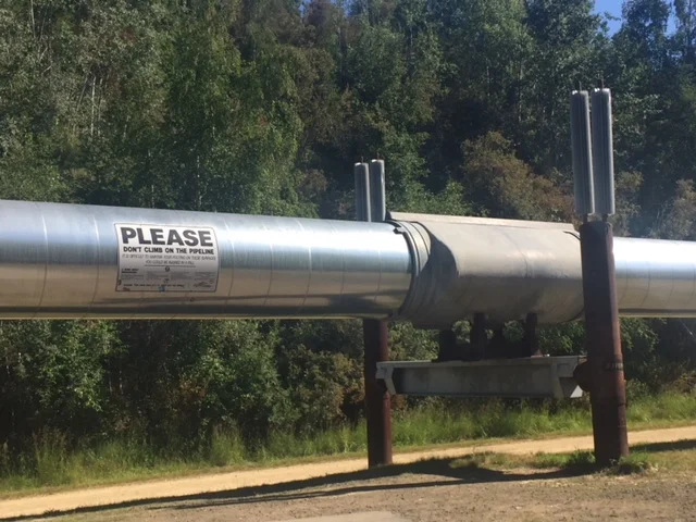
Pipeline support system - Can slide during an earthquake
It crosses over three mountain ranges, and more than 500 rivers and streams as it makes its way bringing oil down to Valdez, Alaska.

Alaska Pipeline Facts
As you cross the Yukon River, there are several pump station outposts, and Alaska DOT maintenance facilities along the way.

Pipeline beside Haul Road
Road crews were out in several places tearing up the frost heaved roads and putting down a new base and “new road” gravel. Once finished, you still have a gravel road but one that the big trucks carrying supplies to the oil fields can maneuver at 50 to 80 miles an hour. In summer it creates a massive dust cloud as they approach and as you pass each other the vehicle is engulfed in a wall of dust, especially if the wind is not blowing it off the roadway. You drive “straight” hoping that another truck is not in the dust cloud or that you have not moved the steering wheel too much causing you to drive off the road you cannot see or into the path of another oncoming vehicle. The dust control trucks try to keep some of the dust down but it does not keep up with the long length of road.
The road and its vistas are amazing with the winding road making its way up and down the hills and mountains. The ever present pipeline is another point to look for as you make you way over one horizon only to see the next horizon with the road and pipeline looming ahead. There is some wildlife along the way, moose, caribou, and bears but for the most part they stay off the road and on the tundra away from human contact. One moose was grazing in a small pond late in the afternoon, evening really, since it was about 9 pm but the sun does not set above the Arctic Circle.

Moose grazing in pond

No Name Creek Sign
For Mark Evans – No Name Creek sign (Remembering your Haul Road Adventure)
Traveling Life’s Highways to the Arctic Circle has had its mishaps, repairs, and the “unknown factor” popping its head up every so often, but all in all, it has been more than one could ask for on this trek.

Arctic Circle Sign
From the Arctic Circle to places south the journey continues.