
Canada/Alaska Drive North
British Columbia, Yukon, Alaska
Thursday – Monday - July 19 – 23, 2018
70° to 80°
“It's a big world out there; it would be a shame not to experience it.”
Anytime you drive through Canada it is a long couple of days. Going south to north almost the whole length of British Columbia there is a large expanse of land to traverse with multiple changes in elevation, vegetation, and topography. Going from Vancouver, BC you have flat, agricultural farm land plus fields of tulips and other flowers. Then abruptly, it changes to mountains, rivers, and canyons for the next few hours. You climb up over one set of mountains and come down to a swift river that you cross and then up, once again over, the next.
Photo – Raging River
We finished the long day of driving and still had not covered 1/3 of the Territory. We were going to stop in Cache Creek but ended up driving further since the weather was good and there was still plenty of daylight as we continued north. We camped in Quesnel, BC at Dragon Lake, it had a beautiful sunset but sadly it was over the trees, not over the lake. It was a nice campground with other road warriors stopping for the night, too. So, it filled up as evening came. Everyone seemed to wrap it up early for a good night’s sleep so they could head out in the morning for places unknown. The next morning, it was interesting to watch as all the campers quickly tore down their camp and RV’s and trailers headed out on the road. Those were the ones that took nighttime showers while those that showered in the morning got a slightly later start.
On the second day’s drive, you continue on the road north past more mountains (driving the Western side of the Canadian Rockies). This was logging country where the log trucks swiftly drove past heading to Prince George or other places to process their loads.

Bear on Mountain (Black spot left center grassy area above dirt spot, below left cloud, lol)
The second night, we camped in Smithers, BC at Riverside Municipal RV Park. It rained most of the day so it was good to get off the road a little earlier than the day before and get some needed rest. The campground is next to a large swift flowing river so you could hear the water rushing by along with the raindrops on the RV roof that provided a great night’s sleep.
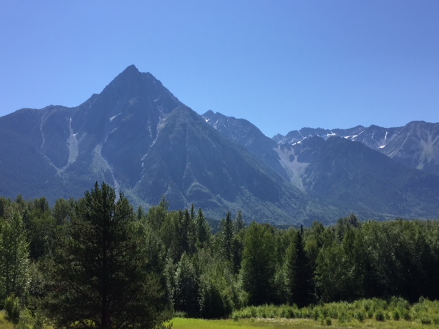
Day 3 - This was a very long day of driving the upper 1/3 of British Columbia. We reached the Yukon Territory that evening. You enter an area that looks like “cowboy country” in Montana or Wyoming. There are multiple ranches, cattle, old churches, and cowboys working the ranges. It was interesting to see the similarities but I guess cowboys are universal, no matter your locale. The mountains on either side of the valley look like mountains in the southwestern US with jagged peaks, buttes, and trees below the timberline.
Smoky Drive through Mountains
Past this stretch, the highway is mostly deserted with little traffic in either direction. There are only a couple of places to buy fuel along the way: Meziadin Junction & Bell 2. Both are tiny outposts in the middle of nowhere and only about 60 miles apart so you better fill up at one or the other. There were many places along this highway where there had been forest fires. Some areas are recovering nicely with new growth while most looked like a darkened burned out stand of ghost trees with little to no vegetation growing, even after twenty years or so.

Dease Lake
Stopped again at Dease Lake, for photos with Placido Flamingo, as the last time came through here it was all covered in ice and snow.

Placido Flamingo at Dease Lake
It was still light outside when we made the turn onto the Alaska Highway. It was time to gas up once again and stop for the night in Nugget City at their little campground. It was a pretty bare bones campground with electrical only but they did have a dump station so it was nice to empty all the tanks and refill fresh water. Nugget City also had a café and gift shop selling native items and Alaskan Highway shirts and stickers.
Day four brought with it a new Canadian Territory, the Yukon, and the drive north on the Alaskan Highway. From Watson Lake you drive past a long beautiful Lake called Teslin. There is a nice bridge over the lake to a small town of the same name. It would be a nice place to have a cabin but it is miles from any major city. Five and a half hours later we arrived in Whitehorse, Yukon. It is on the Yukon River and still has that 1880’s feel to it with old time saloons, a paddle wheel boat. On these cruises, people dress in period costumes. Whitehorse’s main street is filled with small mom and pop shops in a quaint frontier town setting.

Yukon Territory
The drive continued past Haines Junction to Kluane Lake where the next campground was located in Destruction Bay.

Kluane Lake
I have passed it many times driving the Alcan Highway and have wanted to stay there as it is in such a beautiful setting. As you approach the dam that crosses the south end of the lake, one can see many animals either on the road or up on the mountainside. I had looked forward to this for several days but making the 90 degree right turn at the base of the mountain I could see there were no vehicles stopped where the Dall sheep, big horn sheep, and other animals usually were. Looking up on the mountain we did not see anything so continued the ten miles to the campsite.
The camp host was doing her check-in instructions when she stopped and started giving warnings about the bears in the area. Many sightings over the last several days had her husband on “bear patrol”. He had a 4x4 ATV with a “Bear Patrol” sign on it and rifle on the back rack. She showed me the campsite and it was not long before everything was hooked up and it was time to explore. It was about seventy five feet from the site to the lake’s edge so it was fairly easy to walk along the beach where there were many families out with the kids playing in the water (very cold) or skipping rocks across the surface.

Morning sun on Kluane Lake
Up by the office, there were two people singing and playing their guitars for the crowd that had gathered. They played for about an hour and a half and once they finished, a man from Switzerland played a few songs before everyone headed back to their campsites. There were people from several nations camping that night so it was an interesting mix of people and the types of campers everyone traveled in. People sat around camp fires and picnic tables talking with one another. This is one of the great things about being outdoors in a campground. It is natural to talk with people about where they are from, which direction they are headed, and what the road conditions ahead are like. Everyone has a story and it is great listening to others talking about their adventure on the road.
The further north you drive the more light there is late into the evening. It was just after midnight and the sun was just going down past the distant horizon.

After midnight sunset
There would be twilight without total darkness this time of year. The clouds were a beautiful orange color set against a blue sky. If you were driving, you would have to decide whether or not to turn on your headlights as there is still enough light to see without them.
You could hear the “bear patrol” several times during the night hours making the rounds through the campground making sure there were no mischievous bears roaming the grounds.

Raven in Beaver Creek border town
The next morning would be the final drive north getting to the Alaska border and parts north while Traveling Life’s Highways.