Bandelier National Monument
Frijoles Canyon, New Mexico
Thursday, May 31, 2018
Clear, 95°
“Truly it may be said that the outside of a mountain is good for the inside of man.” – George Wherry
There is a beautiful drive to the northwest of Santa Fe that leads to Bandelier National Monument (NM) featuring distant vistas and towering mountains in several directions
Bandelier National Monument Sign
Like other National Monuments, it is run by rangers for the National Park Service. They man and maintain the Monument and surrounding areas within its boundaries, preserving an important link in the history of the Pueblo people.
Dwelling with Petroglyph
Adolph Bandelier, after whom the park is named, was one of many people to become fascinated with the story of the inhabitants of Frijoles Canyon. Archeologist and other scientists have studied the evidence of the Ancestral Pueblo culture in an attempt to reconstruct the story of these early people.
Horse Petroglyph on Wall
There are five Ancestral Pueblo Groups in the Four Corners area in the United States which border Utah, Colorado, Arizona, and New Mexico. They are known as Chaco, Mesa Verde, Little Colorado, Kayenta, and Rio Grande. There are 19 Monuments within this four state region giving all kinds of opportunities to explore the different tribes and its culture.
Adobe Cliff Dwelling
The area around this park is part of the Pajarito Plateau, formed by two violent eruptions of the Jemez Volcano more than a million years ago. Located fourteen miles to the northwest, this powerful volcano ejected enough material to cover this four hundred-square-mile area with a layer of volcanic ash up to one thousand feet thick. Each of the two Jemez eruptions was six hundred times more powerful than the 1980 eruption of Mount St. Helens. (Info from the Bandelier National Monument Brochure)
Nature’s Eruption
Today is hot, like many days on this trip, so with plenty of water and snacks in hand the hiking trail is about one and a half miles when taking in all 21 stops on the self-guided tour. The path leading out into Frijoles Canyon is paved and winds its way through the different desert vegetation. There are squirrels and a few rabbits wandering around looking for shade or foraging for food.
Squirrel
The trail starts out fairly flat until you reach the first Big Kiva pit. There are the remains of a central plaza with three kiva pits and what once was a small two story village (Tyuonyi) which once contained approximately 400 rooms that housed approximately 100 people.
Kiva Pit
Ancient Village Walls
Walking past this village, a climb starts up to the canyon wall to the cliff dwelling living areas. The trail curves its way around leading to several different sections of stairs gaining altitude to the cliff dwellings. Several had wooden ladders to gain entrance into the cave rooms or “cavates”.
Kiva Ladder
The cliff dwellings are on the south face of the canyon wall, which provides warmth in winter months, rather than the shaded northern side of the canyon.
Cliff Dwelling
The path gets narrower and the steps single file as you climb up to the higher cavates.
Narrow Path
Looking out over the valley floor you see the small village below and the panorama of the canyon walls, the Frijoles Creek flowing toward the Rio Grande River, is not far from this site.
Valley view of ancient village
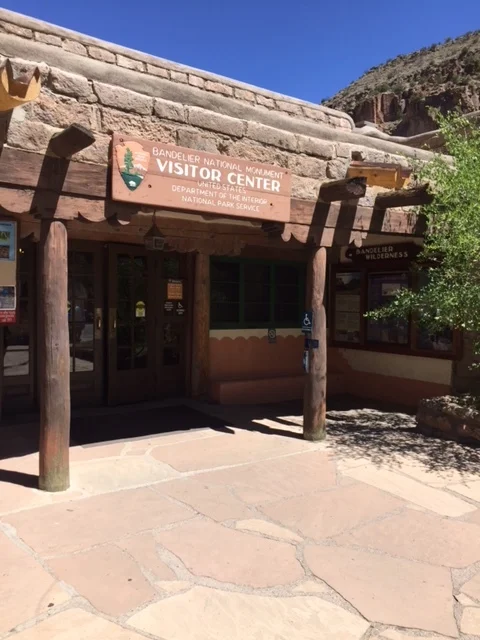
Due to limited parking on site, there is parking close by in White Rock at the Visitor’s Center where a shuttle easily takes you to the Monument.
White Rock Visitor’s Center
If you arrive before nine in the morning or after three in the afternoon, you may be able park at Bandelier but otherwise it is mandatory to take the shuttle.


